
Explore our world-class mountaineering library, apply for one of our grants, and dig in to your member resources.

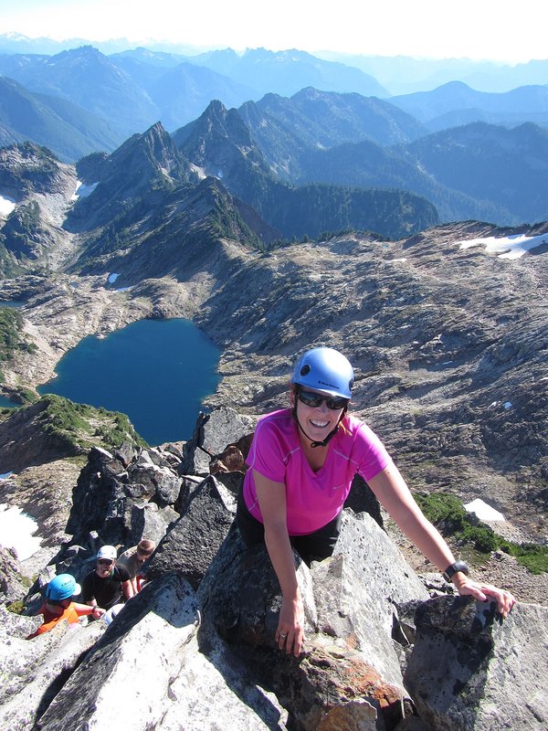

Mt. Yoran is located in the Diamond Peak Wilderness area southwest of Odell and Crescent Lakes in the Willamette Pass area, an area known as Divide Lake Basin. The mountain is an eroded volcanic plug. Be prepared for mosquitoes in early summer and huckleberries in late summer/early fall.
The final section is a rock scramble, mostly easy 3rd and short bit of steeper 4th class.
Views from the top include Odell Lake, Willamette Pass ski area, Diamond Peak. Many more peaks can be seen in the distance.
Activity Notes
Mount Yoran is a craggy volcanic monolith standing at 7100’ off the north shoulder of Diamond Peak, adjacent to the PCT.
The most straightforward climbing route begins above Divide Lake, scrambling a prominent Class 3-4 couloir up the south face, leading to some airy traverses to the summit.
The approach trail begins near Oakridge, OR at the Vivian Lake Trailhead, and climbs gently through rich stands of mountain hemlock and past several pristine lakes in the Willamette National Forest. The full car-to-car route, including the climb, totals 10 miles. The summit is a spicy accomplishment, and rewards with spectacular views up and down the Central Cascades, and close-up to Diamond Peak.
This climb offers an excellent skills progression from walk-up PNW peaks, to more ambitious technical alpine crags.
PLEASE NOTE: Although "A-level" rated, this route involves climbing sustained Class-3 and Class-4 terrain with significant exposure. Applicants must be comfortable with these conditions.
| Other Information | |
|---|---|
| Driving Distance from Portland | 180 miles |
| Driving Time from Portland | 3 hours |
| Distance - Round Trip | 8 miles |
| General Route Info | A rock scramble, mostly easy 3rd and short bit of steeper 4th class. Minimal technical skills are required, and at only an 1800 foot elevation gain, this one ought to be within range for most anyone! |
| Expected Duration | Car to car in one day |
| Relevant Books | 75 Scrambles In Oregon by Barbara Bond. Climber's Guide to Oregon by Nicholas Dodge. |
| Relevant Maps | USGS 7 minute series, Diamond Peak and Willamette Pass, and Diamond Peak Wilderness Map, by Geo-Graphics. Willamette Nat'l Forest or Middle Fork Ranger District maps are useful for finding the trailhead. |
| Useful Links | GPS Track GPS Coordinates Map |