
Explore our world-class mountaineering library, apply for one of our grants, and dig in to your member resources.

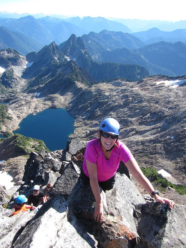

This is a prominent peak very close to Rainy Pass in the North Cascades. Beckey calls the NE route €œmore technical route than the normal way, but not forbidding; the ridge is exposed class 3 and 4 with one class 5 pitch."
Activity Notes
An accessible, moderate climb (Grade III, low 5th class rock, up to 30° snow) near Washington Pass. The approach is enjoyable and travels through Heather Pass and past Lewis Lake to camp at Wing Lake (6,900 ft). The rock can be loose in places but improves higher on the route.
Because it's a long drive, we'll carpool from Portland early on Friday morning. We'll hike in after the drive, climb Saturday and then hike out and drive home on Sunday. It will be a long, and hopefully, worthwhile weekend!
From Wing Lake, follow the hogsback moraine wide right and then traverse back left to the notch. At the ridge, we'll roped up and start simul-climbing.
There are many towers on this ridge, but unlike a true ridge climb, you bypass most of them at the 5.3 grade. Especially low down on the ridge, there are all these crumbly vertical towers which we bypassed by scrambling loose ledges and gullies 50 ft below to the left.
About 1/3 of the way through the climb, we should arrive at a notch where the obvious path should take us slightly right onto the west side of the ridge and up a low 5th section. This should be one of the most exposed parts of the climb.
Above this, we should stay predominantly on the ridge crest, making low 5th moves. Reports say the rock is solid on these sections. Higher up, we should approach a dark, steep looking headwall. From afar, it looks like we should bypass it, but when we get closer, we should see that it was just some steep low 5th climbing.
The descent was marked with cairns that rotated clockwise off the summit to gentler terrain that led to the south ridge route. We took the second gulley down after exploring all of the possible entry points short of the large bluff. It was steep and quite dirty with scree over a hard bed.
| Other Information | |
|---|---|
| Driving Distance from Portland | 330 miles |
| Driving Time from Portland | 7 hours |
| Expected Duration | Car to car in two or more days |
| Relevant Books | Cascade Alpine Guide: Columbia River to Stevens Pass by Fred Beckey |
| Relevant Maps | Green Trails, Washington Pass, WA, No. 50, and Mt. Logan, WA, No. 49 <href="http: maps.google.com="" maps?f="q&source=s_q&hl=en&geocode=&q=Black+Peak+WA&sll=36.919389,-116.81395&sspn=0.010533,0.022616&g=Black+Peak&ie=UTF8&ll=48.523455,-120.815663&spn=0.017452,0.045233&t=p&z=15&iwloc=addr"" title="Google map">Google map</href="http:> |
| Useful Links | GPS Track GPS Coordinates Map |