
Explore our world-class mountaineering library, apply for one of our grants, and dig in to your member resources.

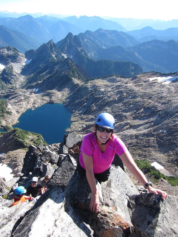

From Summitpost: When its namesake spire was blown off in a storm in 1911, this High Cascade peak was almost forgotten about and still is not very well known. But being the high point halfway between Mt. Thielsen and Diamond Peak, this rocky-topped peak has great views from Crater Lake to the Three Sisters. The summit has a Class 2/3 scramble after a mostly gentle hike along the Pacific Crest National Scenic Trail.
Activity Notes
August 1 Update: Leaders have been closely following the developing Central Oregon fire and weather situation over the past 10 days A lightning storm passing over the Willamette National Forest on July 17 started numerous wildland fires The Diamond Peak Wilderness Area is closed as is the Pacific Crest Trail section in the area for the rest of 2024. This includes trailheads and trail for all three climbs This is an early start to the Oregon wildfire season. Nation-wide, all resources have been deployed. Fire crews are focusing on areas of high population density and infrastructure Unfortunately, there are minimal fire resources being prioritized around Diamond Lake and the high heat forecast over the next 5 days is unfavorable Campgrounds in the Diamond Lake did close last week and have recently re-opened but are subject to closure again There is a new fire near Crater Lake, and we anticipate wilderness/recreation closures These fires and the fire(s) near LaPine are producing unhealthy air quality from Bend South to Klamath Basin. Air quality is a function of fire location, smoke, wind direction and cloud cover. A change in any of these factors and the air quality swings from healthy one day and to hazardous the next. Lesson?s Learned: Mid-June to early July is a better time to climb in the Diamond Lake Wilderness. Hoping to offer a similar multiple climb plan in the Diamond Peak wilderness in 2025. The mountains will be there. Best to be safe, cancel now and allow folks to plan alternate adventures. Preference will be given to 2024 BCEP students and BCEP students from Team 04 Applicants should be able to keep a steady pace for the 4.5-mile approach. Climbing skills required : 4th/low 5th class rock scrambling Leader will be camping at Timpanogas Campground the nights of 23 and 24 August. The area is prone to lightning and climb start time may need to be adjusted for an earlier start Timpanogas Lake is the starting point for Cowhorn Mountain summit. Timpanogas Lake has a campground which has first come first serve. The day use parking area is just past the campground, and it has room for about 15 cars. From there we will walk back down the road to Timpanogas Lake and find the trail beginning on the left (southwest) side of the lake. For 0.25 miles we walk around the west side of the lake, pass by the Timpanogas cabin and then come to a trail junction. Head up the Start O'Willamette Trail #3642 as it switchbacks uphill for 1 mile through hemlock and pine trees and T's into the Windy Pass Trail. At this trail junction we take a right onto the Windy Pass Trail #3643 and continue heading uphill through a thick forest for 2.6 miles. Overall, most of this hike is not very interesting because there aren't many viewpoints until we get up higher, but the climb through the forest can be very relaxing and extremely quiet as this area is not heavily trafficked. After 2.6 miles, we look for a sign on the left-hand sign indicating a tie trail over to the Pacific Crest Trail. Take a left on this 0.2-mile traverse and arrive at the PCT. Take a right onto the iconic Pacific Crest Trail and from here we will start seeing Cowhorn Mountain in the distance. After 0.3 miles on the PCT, rock cairns mark the climber trail up to the Cowhorn Mountain summit. The climber trail is a non-technical climb as it meanders through mountain hemlock trees for a bit until we get above tree line. The trail goes along the ridgeline as we switchback up to right before the summit. This stretch is just half a mile long. The last 500 feet to the summit are an extremely steep. From the summit of Cowhorn Mountain you will get 360-degree views, and it is fantastic! To the north you can see Crescent Lake, Summit Lake, Diamond Peak and the Three Sisters as well as Broken Top and Mount Bachelor. We will take lunch on the summit and retrace our route back to the trailhead. Bring a swimsuit and we might take a refreshing dip in the lake. Driving Directions: From Oakridge, OR Drive OR-58 E for 1.8 miles, then turn right onto Hills Creek Rd/Kitson Springs Rd. for 0.5 miles. Turn right onto NF-21, cross a bridge and turn left to stay on NF-21 for 10.3 miles. Cross a bridge and pass Bingham Boat Launch and continue to the right on NF-21 for another 21 miles. Turn left onto Rigdon Rd/NF-21 for 0.5 miles, then continue straight at a corner on NF-2154 for 3.6 miles. Turn right onto NF-365 for 4.3 miles, then turn left at a sign for Timpanogas Lake and continue through the campground, past the lake and end at a round trailhead parking lot. https://www.hikeoregon.net/cowhorn-mountain.html| Other Information | |
|---|---|
| Driving Distance from Portland | 215 miles |
| Driving Time from Portland | 4 hours |
| Distance - Round Trip | 9 miles |
| General Route Info | Hike along the well-graded PCT about 4 miles to the climbers route to the summit. The best rock on the route is the summit block. An enjoyable scramble leads to the top. Another option for this climb is to approach from Summit Lake. Two trails lead to Cowhorn from this area: the PCT and Windy Pass Trail. It is possible to go up one of the trails and return on the other, making a fine loop hike, though the two trailheads, ≈2 miles apart, are connected by forest service roads. A short car shuttle eliminates the need for hiking the road. |
| Expected Duration | Car to car in one day |
| Relevant Books | 75 Scrambles in Oregon , by Barbara Bond |
| Useful Links | Map |